
PRIVATE GUIDED DAY WALKS
Cape Raoul
Tasman Peninsula
Track Grade
T2 – Narrower but distinct tracks.
Location
Tasman Peninsula, Tasmania
Track Length & Type
15.6km return
Price
From $249 per person
Cape Raoul Private Guided Day Walk
Luggage Storage
Lunch & snacks
On trail experienced Guide
CBD Pick-ups begin at 7:15am
No Minimum Numbers
Guaranteed Departures
Overview
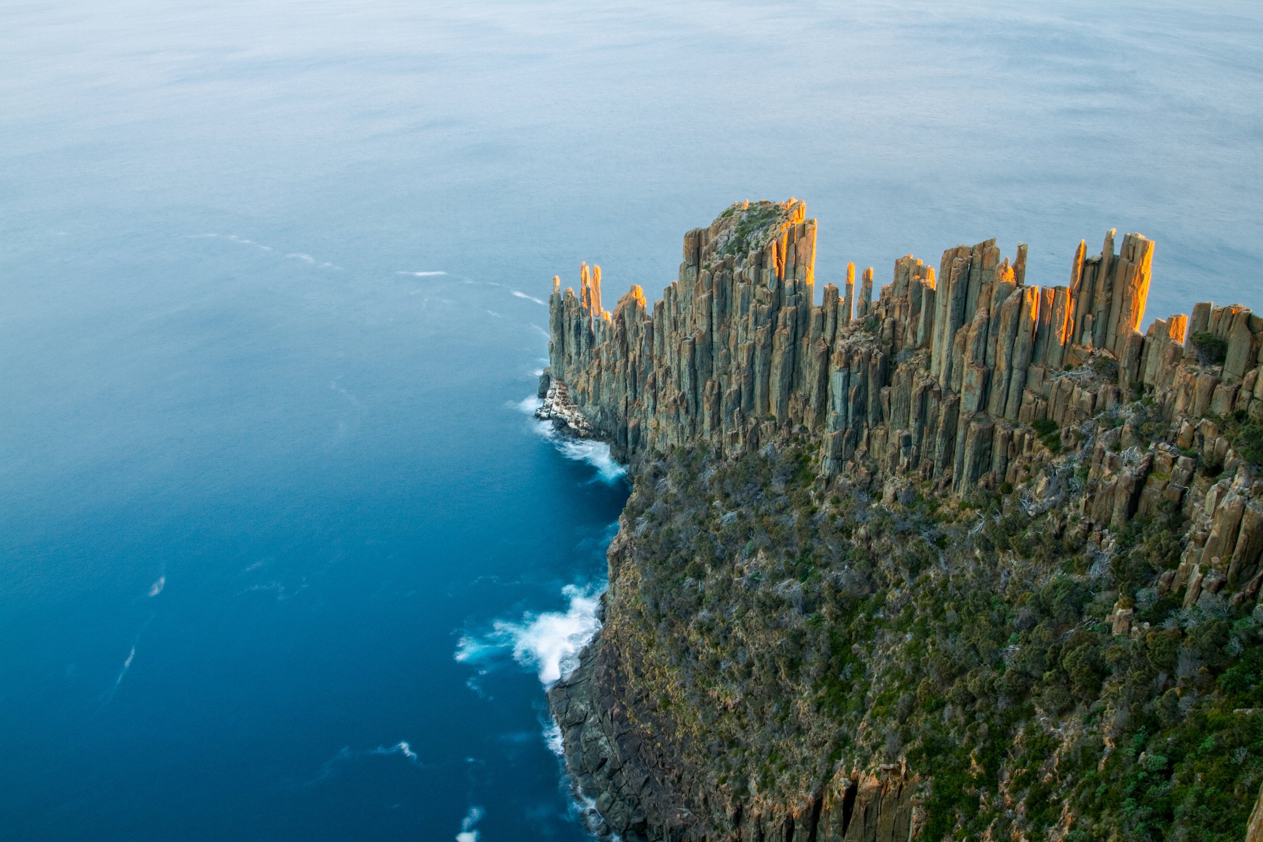
An intriguing walk through a variety of landscapes and plant communities, culminating in the stunning view of Cape Raoul.
Track grade: T2, narrow but distinct tracks.
Track length & type: 15.6km, out and back.
Times: 7.30am Hobart departure, returning approximately 5.00pm
What’s included
Return transfer to Cape Raoul from Hobart CBD address (your accommodation)
Lunch & snacks
On-Trail Experienced Walking Guide
Walking jacket / outer layer if required
Water to refill your drink bottle
First Aid kit
See our full list and guide on what to bring and how to prepare for your walk here.
About the walk
Much of Tasmania’s most dramatically beautiful coastal scenery is found on the east coast of the Tasman Peninsula in the south-east of the state and the walk to Cape Raoul (one of Tasmania’s 60 Great Short Walks) is the southernmost point on the Peninsula. To access the walk, we travel southeast from Hobart on the Tasman Highway, over the Dunalley Canal and the Forestier Peninsula to the infamous Eaglehawk Neck on the Tasman Peninsula, and then past the Port Arthur settlement to our trailhead at Stormlea.
From here we enter the coastal forest of tall stringybark eucalypts (Eucalyptus obliqua) with an attractive and varied understory before arriving at our morning tea spot – the breathtaking and precipitous cliffs overlooking Shipstern Bluff to the west and Cape Raoul to the east. From here the character of the scenery changes to one of a remnant rainforest sustained by sea-mist (a cloud forest) with seemingly out-of-place ora more usually found at higher and wetter altitudes, then to a dry she-oak (Allocasuarina littoralis) grove as we skirt the precipitous cliffs above the sea below, and finally to a wind-pruned plateau of coastal heaths (Epacridaceae sp.) and dwarf banksias (Banksia marginata) before we arrive at our lunch stop atop the vertiginous cliffs overlooking the dolerite columns of Cape Raoul.
The route generally is a pleasant and easily traversed bush track, with some steep sections and some quite thrilling sections close to the cliff edges requiring careful negotiation.
Before you book
-
Our tour grading is based on Tasmania’s track classification system:
T1 – Easy to Moderate
Well defined and wide tracks on easy to moderate terrain, in slightly modified natural environments. You will require a modest level of fitness. Recommended for beginners.
T2 – Moderate
Narrower but distinct tracks which can be muddy in some places, in pristine natural environments. Facilities are minimal and you will encounter few other walkers. These moderate tours require reasonable level of fitness.
T3 – Challenging
You will experience marked but often-indistinct tracks, in very remote and wild areas. These challenging walks need a high level of fitness and some hiking experience.
T4 – Difficult
Tracks are often faint or unmarked in remote and craggy natural areas not included in our schedule, however we will guide selected parties on these tours on request.
-
Arrival & Departure Locations & Times
Guided Day Walks leave from your nominated pick-up address in Hobart CBD.
Departure times are strictly between 7:30 - 8:00am.
Prices, Deposits & Surcharges
Prices are as advertised. A 25% deposit is required at the time of booking. Full fare must be paid at least seven days in advance of the scheduled pickup date.
With ever-increasing fuel and staffing prices, regrettably, our fares are subject to change without notice, so please check with us for the current fare before making your travel arrangements.
-
Please refer to our cancellation policy here.